Jebel Ali (Jebel Ali)
Jebel Ali (جبل علي) is a port town 35 km south-west of Dubai. The Jebel Ali Port is located there. Al Maktoum International Airport has been constructed just outside the port area. Jebel Ali is connected to Dubai via the UAE Exchange (formerly Jebel Ali), Danube (formerly Jebel Ali Industrial) and Energy stations on the Dubai Metro. Among the infrastructure projects built to support the port and town is the world's largest desalination plant, the Jebel Ali Desalination Plant (Phase 2), providing an ample supply of freshwater.
Many Arab historians argue that it was named after Ali, who was the cousin and son-in-law of Muhammad while expanding the Islamic Caliphate had stood on one hill and looked towards the sea and perhaps known as well although no such recorded proof has been found. "Jebel" means mountain or hill in Arabic.
In 1968, Overseas AST started construction of Dubai's first Communications Station in the Jebal Ali area, because of the raised ground. It was commissioned in 1970, giving for the first time telecommunication links with the rest of the world. In the 1970s, Sheikh Rashid bin Saeed Al Maktoum planned to develop Jebel Ali into an industrial area with its own airport, port, and township.
On 23 September 1983, Gulf Air Flight 771 crashed in Jebel Ali killing all 112 people on board. The cause of the crash was a terrorist bomb that had been planted onboard the aircraft by the Abu Nidal Organization.
Map - Jebel Ali (Jebel Ali)
Map


Country - United_Arab_Emirates
 |
 |
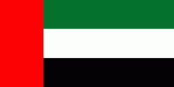
| Flag of the United Arab Emirates | |
The United Arab Emirates is an elective monarchy formed from a federation of seven emirates, consisting of Abu Dhabi (the capital), Ajman, Dubai, Fujairah, Ras Al Khaimah, Sharjah and Umm Al Quwain. Each emirate is governed by an emir and together the emirs form the Federal Supreme Council. The members of the Federal Supreme Council elect a president and vice president from among their members. In practice, the emir of Abu Dhabi serves as president while the ruler of Dubai is vice president and also prime minister. In 2013, the country had a population of 9.2 million, of which 1.4 million were Emirati citizens and 7.8 million were expatriates. , the United Arab Emirates has an estimated population of roughly 9.9 million.
Currency / Language
| ISO | Currency | Symbol | Significant figures |
|---|---|---|---|
| AED | United Arab Emirates dirham | دإ | 2 |
| ISO | Language |
|---|---|
| AR | Arabic language |
| EN | English language |
| HI | Hindi |
| FA | Persian language |
| UR | Urdu |